For the past month, South Sudan has been engulfed in an expanding civil war. Unlike Sudan, where the Satellite Sentinel Project pioneered its work, with a few limited exceptions, South Sudan’s government has been allowing both journalists and humanitarians to operate around the country, even as violence spreads. As a result, harrowing videos, interviews, and photographs documenting the crisis have been emerging for weeks.
The United Nations estimates that over 395,000 people have been displaced by violence, 352,000 internally, of which 60,000 have sought shelter at U.N. compounds around the country. Another 43,000 are refugees in neighboring countries including Sudan, Ethiopia, Kenya, and Uganda, with an estimated 3,000 to 4,000 people from South Sudan arriving daily in Uganda alone. Although no mortality surveys have been conducted, conservative estimates suggest that thousands have died in the fighting, which was triggered by a political struggle between competing factions of the ruling party.
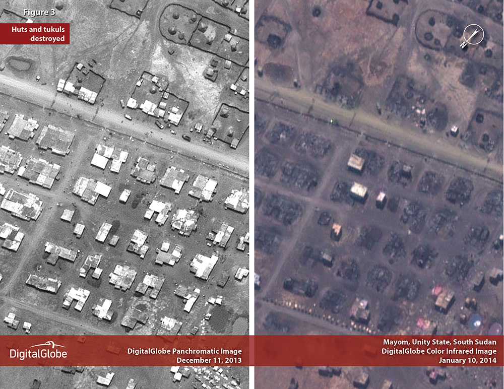
The Satellite Sentinel Project has just released a new report, that augments existing reporting on South Sudan's civil war with satellite imagery of Mayom and Bor, captured from 300 miles above the earth. Digital Globe imagery offers independent confirmation of the scale of South Sudan's civil war with vivid evidence of the intentional destruction of civilian dwellings and market areas. UN bases in both Bor and Bentiu are crowded with displaced people. Images of Mayom show civilians fleeing en masse.
South Sudan's crisis is not unfolding in the dark, but enhanced documentation efforts are essential to combat impunity and ensure accountability for crimes committed during the course of hostilities. The Satellite Sentinel Project will continue to monitor all parts of South Sudan experiencing violence.

